MOUNT LOOKOUT COMMUNITY COUNCIL
The MLCC is an all-volunteer organization that informs, serves, and advocates for the residents and businesses of Mt. Lookout, Cincinnati. Founded in 1906, it is the oldest continually operated civic organization in the State of Ohio.
|
About Mount Lookout
In the Archive so far: "Images of America: Cincinnati's Mt. Lookout Neighborhood" by Jason Fitzhugh "History of Mt. Lookout" by Robert Rodger "The History of the Mt. Lookout Dummy" by John H. White, jr Scroll down to view.
|
 Mt. Lookout Memory Lane
"Images of America: Cincinnati's Mt. Lookout Neighborhood" by Jason Fitzhugh published by Arcadia Publishing Originally a small village called Delta, Mt. Lookout was annexed by the City of Cincinnati in 1870 and was renamed after the new Cincinnati Observatory was built at the end of Observatory Place. Author Jason Fitzhugh has researched the history of Mt. Lookout and curated a selection of over 150 archival images chronicling our community's early beginnings to the thriving, established neighborhood it is today. Learn more and to purchase the book. |
|

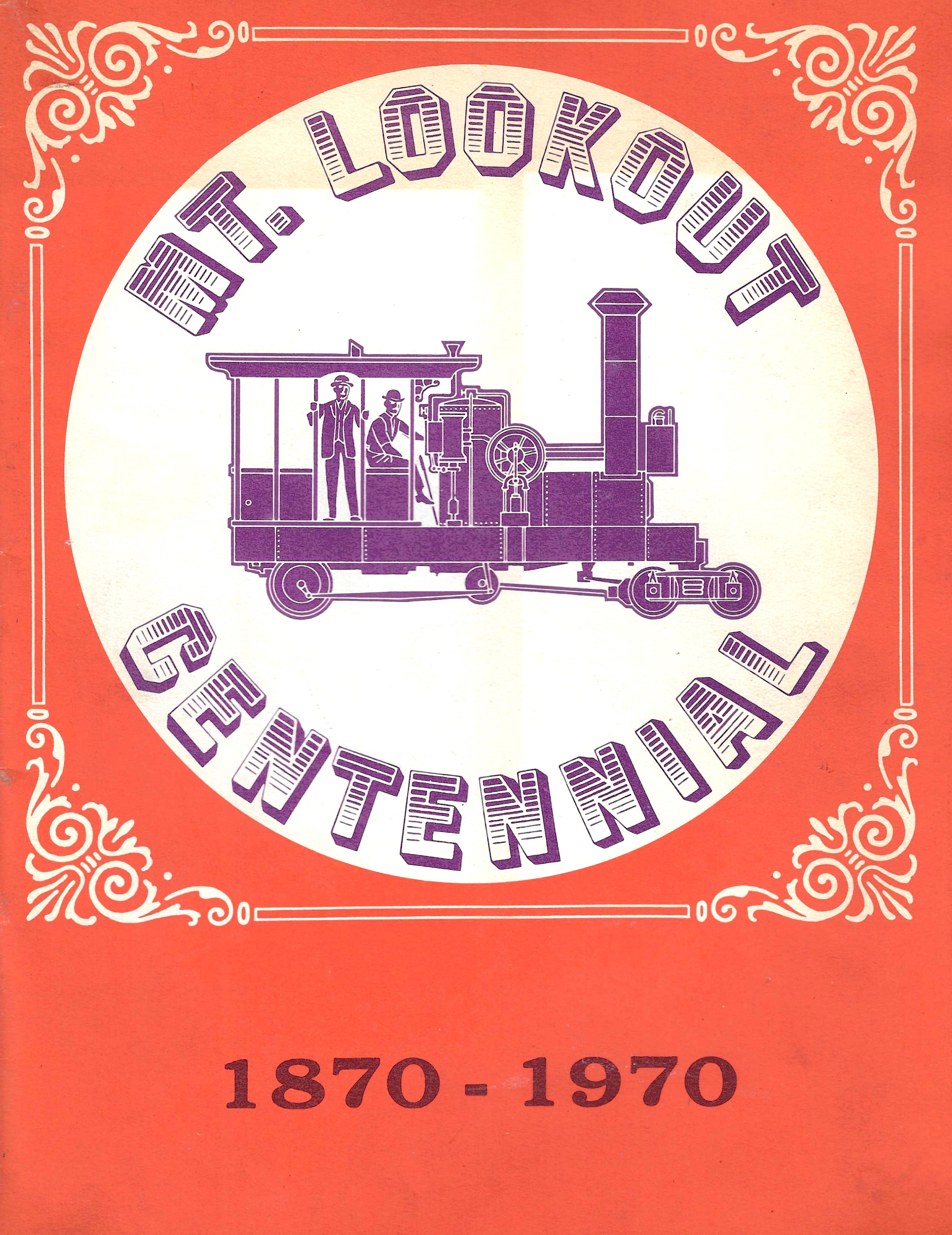
by Robert Rodger originally published in the Mt. Lookout Centennial commemorative magazine: |
|
|
|
|
|
|

|
|
|
|
|
|
|
|
|
|
|
|
|
|

|
|
|
|
"The History of the Mt. Lookout Dummy" by John H. White, jr originally published in the Mt. Lookout Centennial commemorative magazine |
|
|
|
|
|
|
|
|

|
|

|
|
|
|
|
|
.jpg)
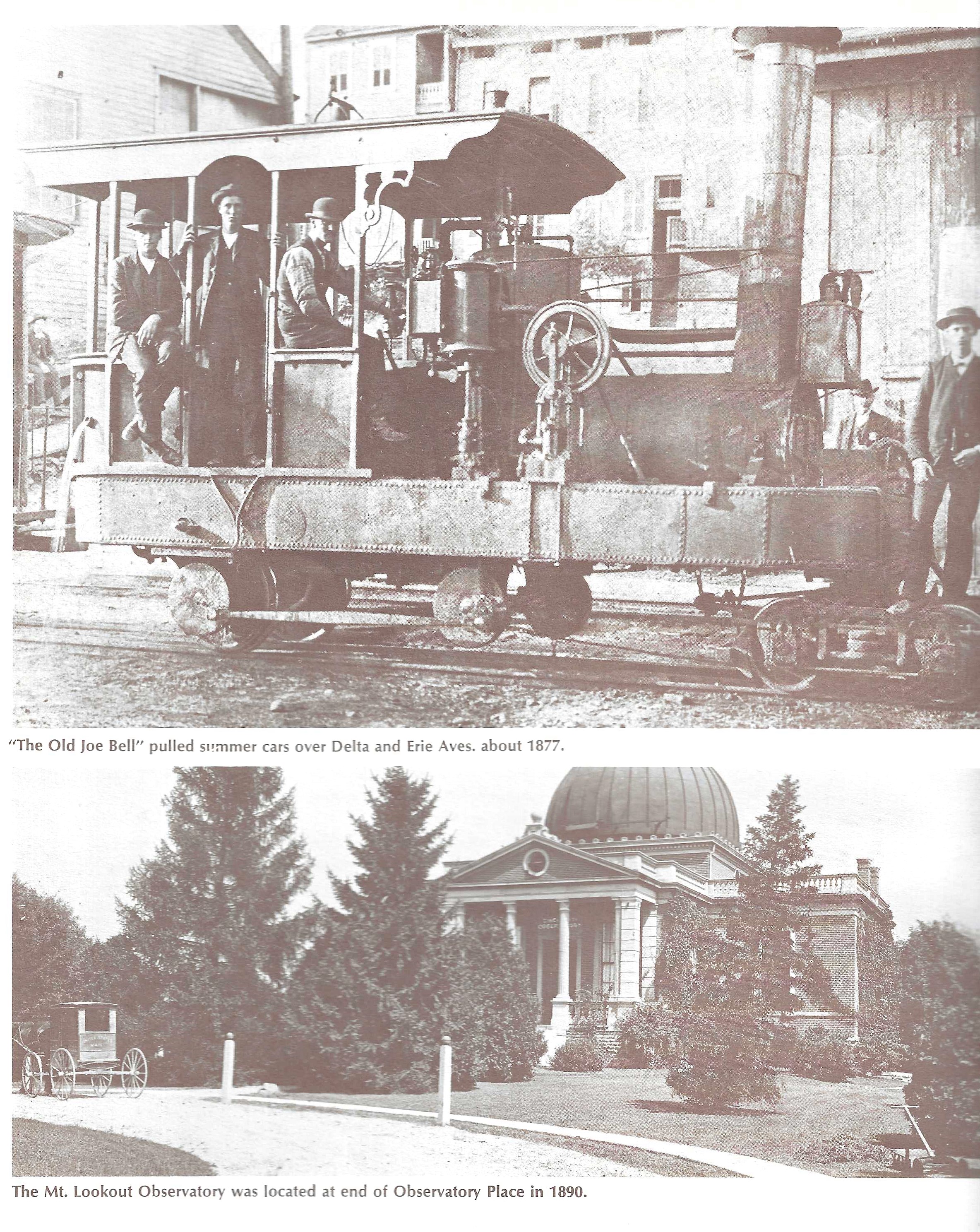
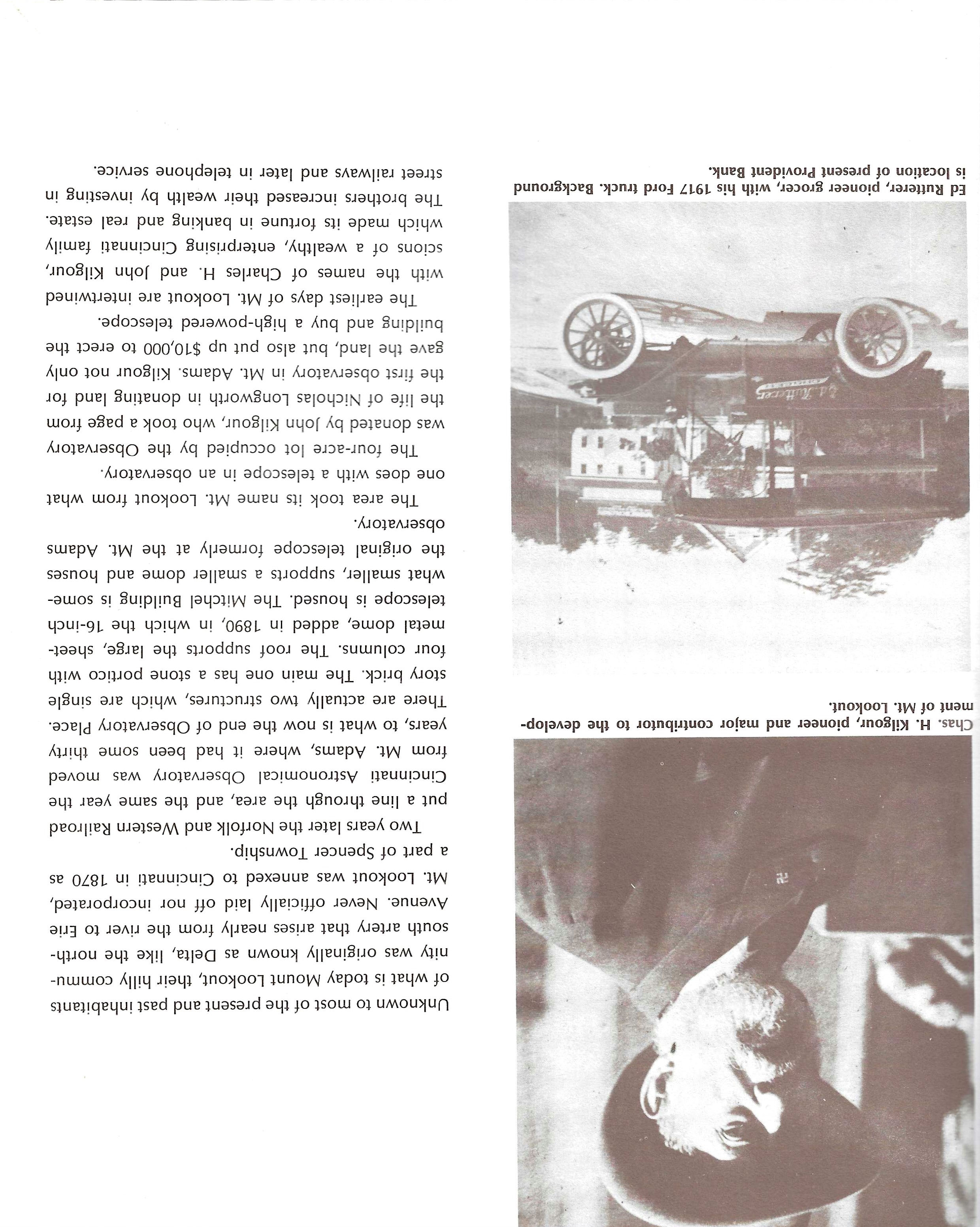
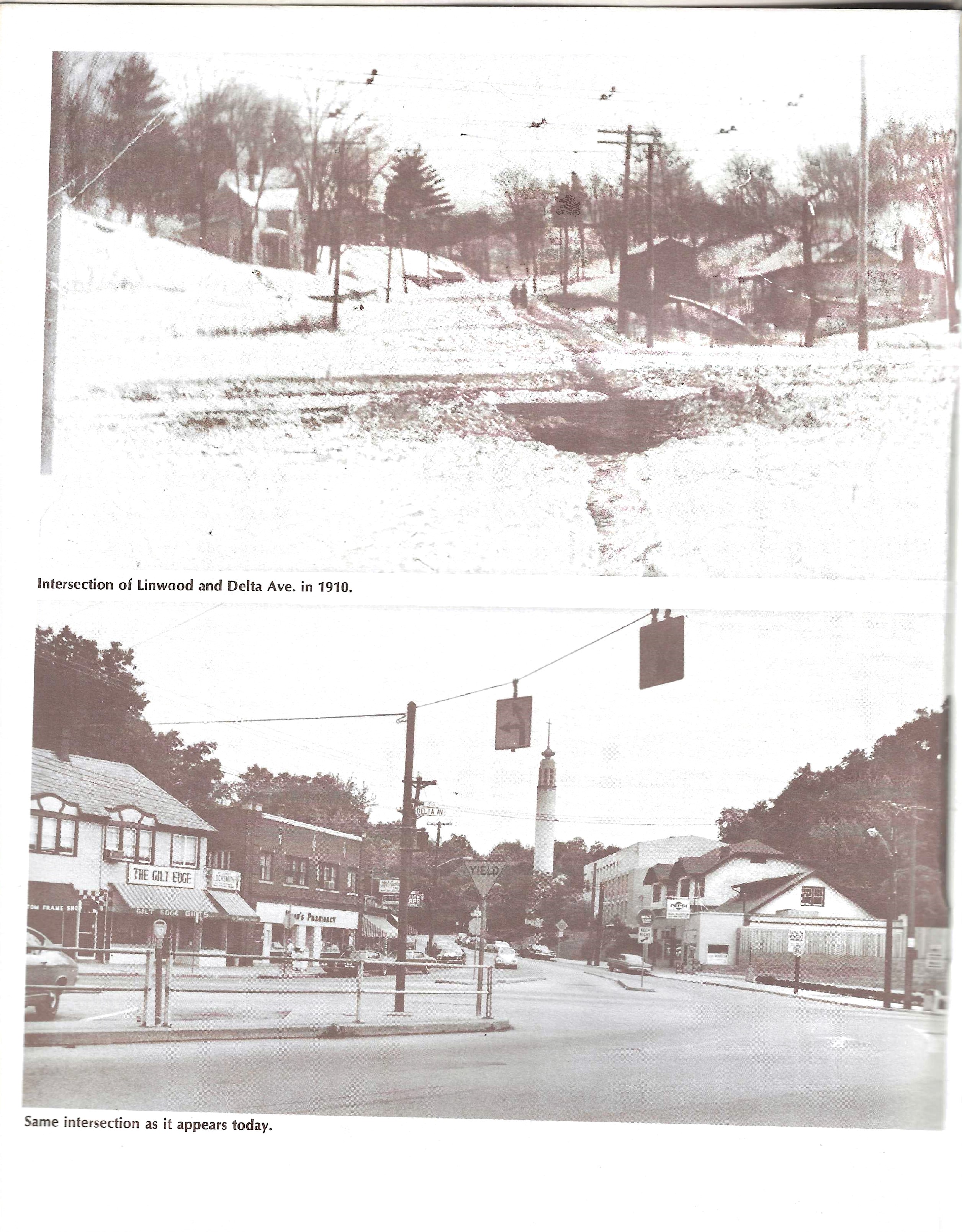
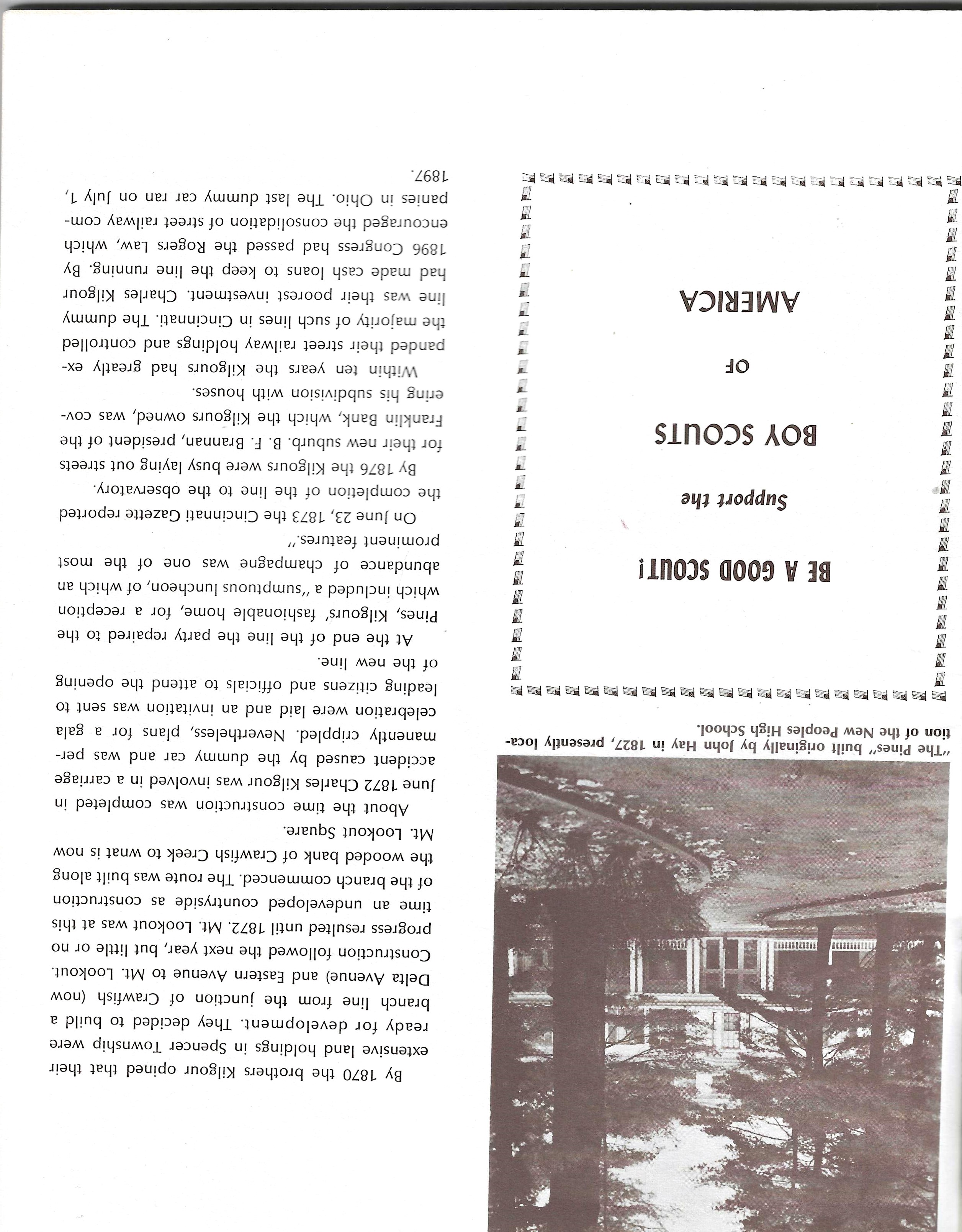
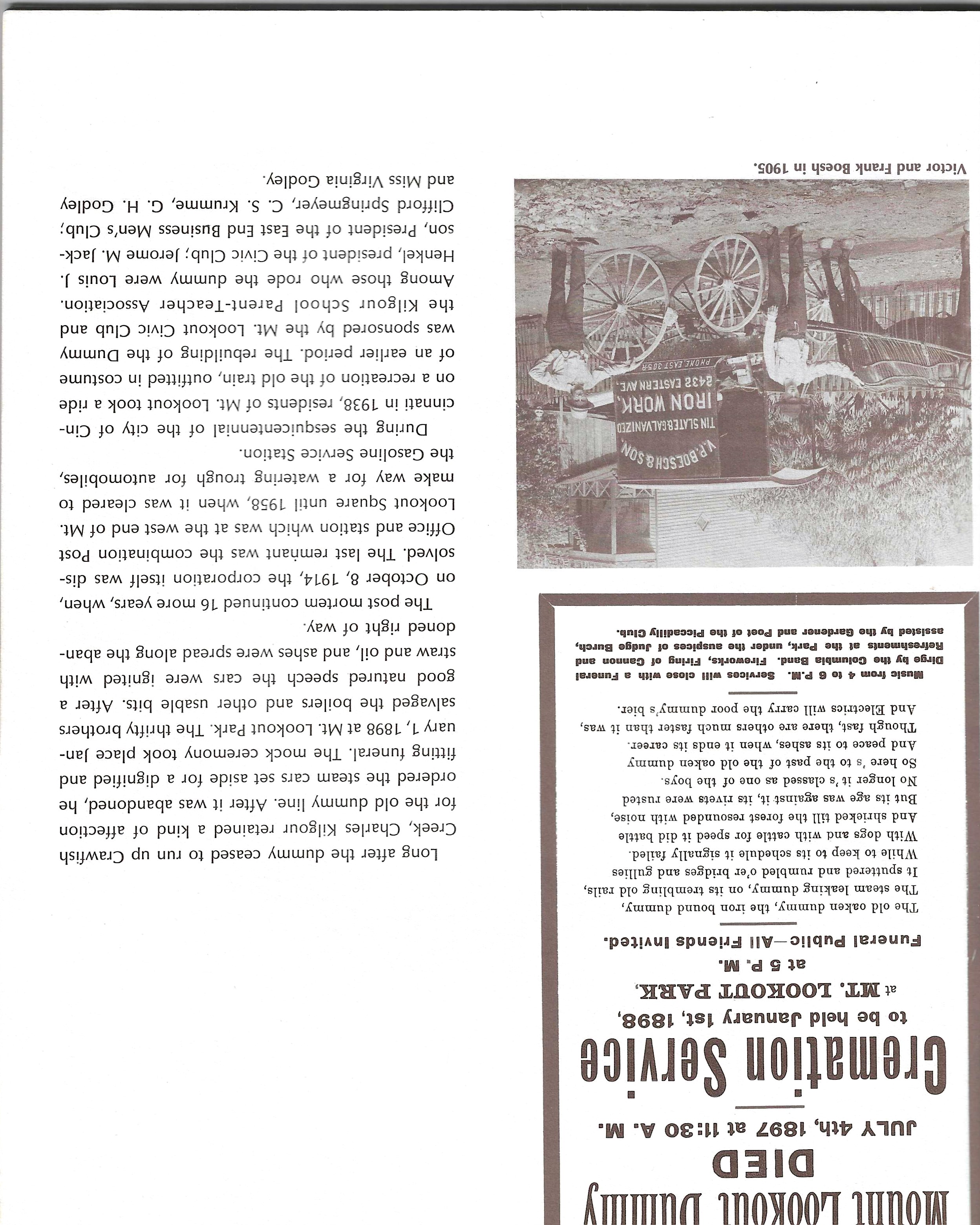
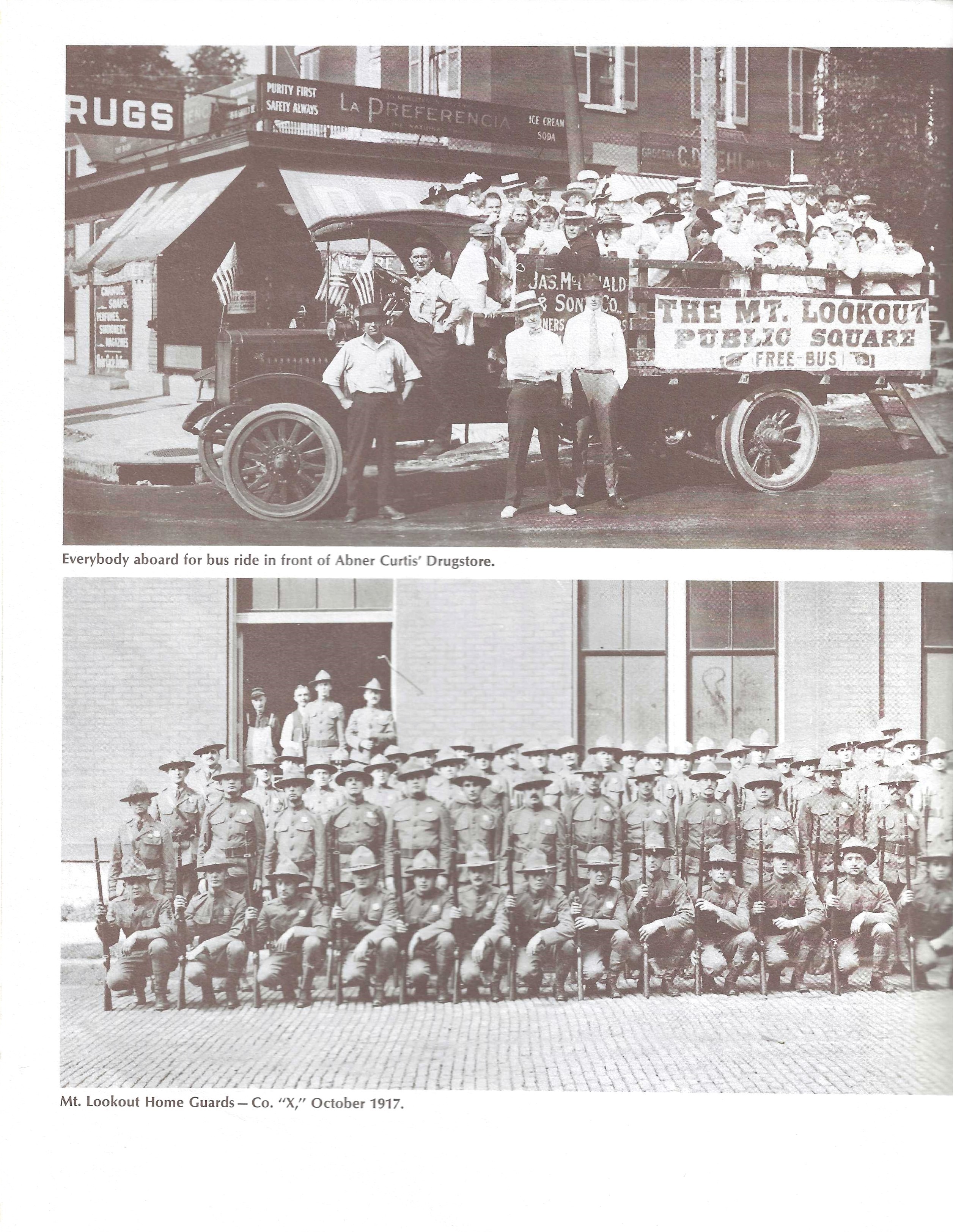
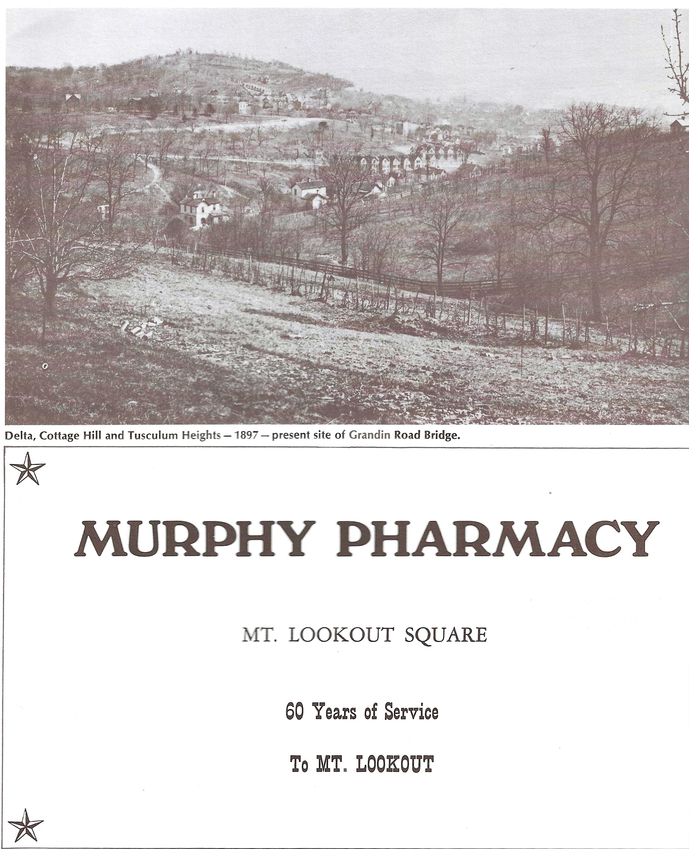
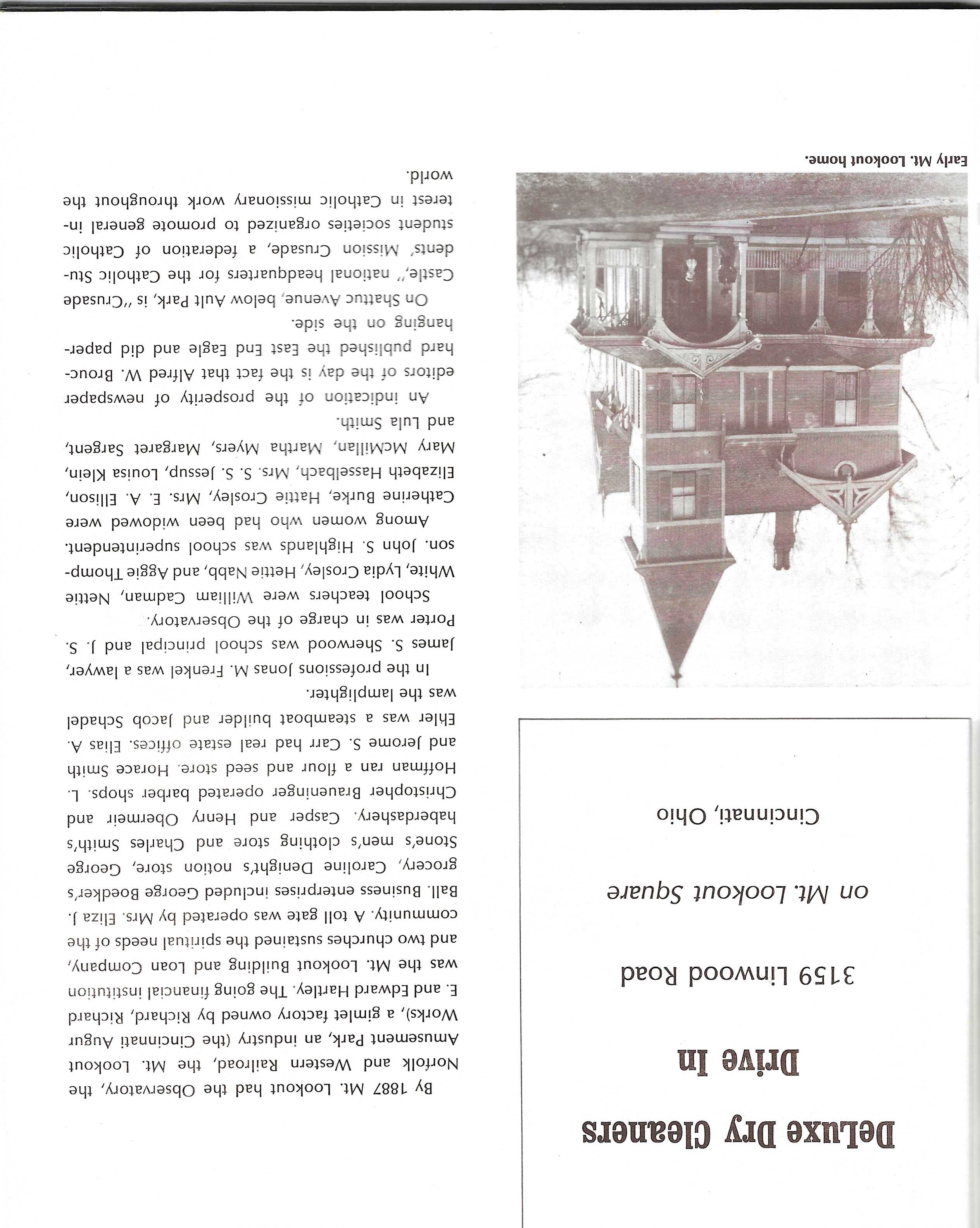
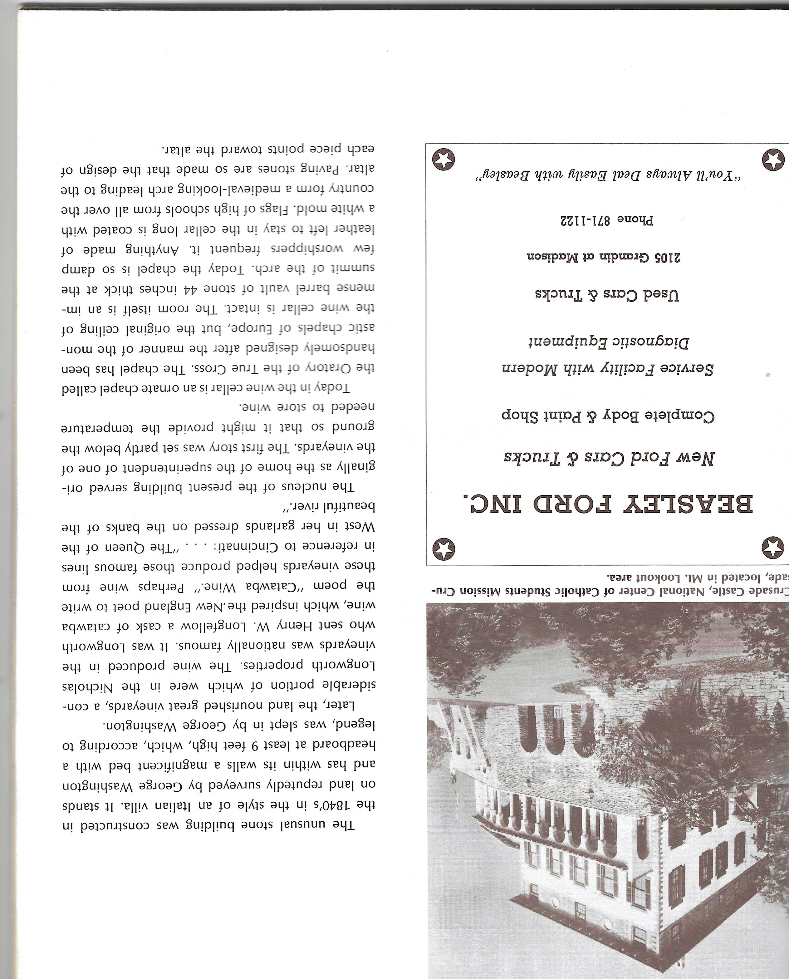
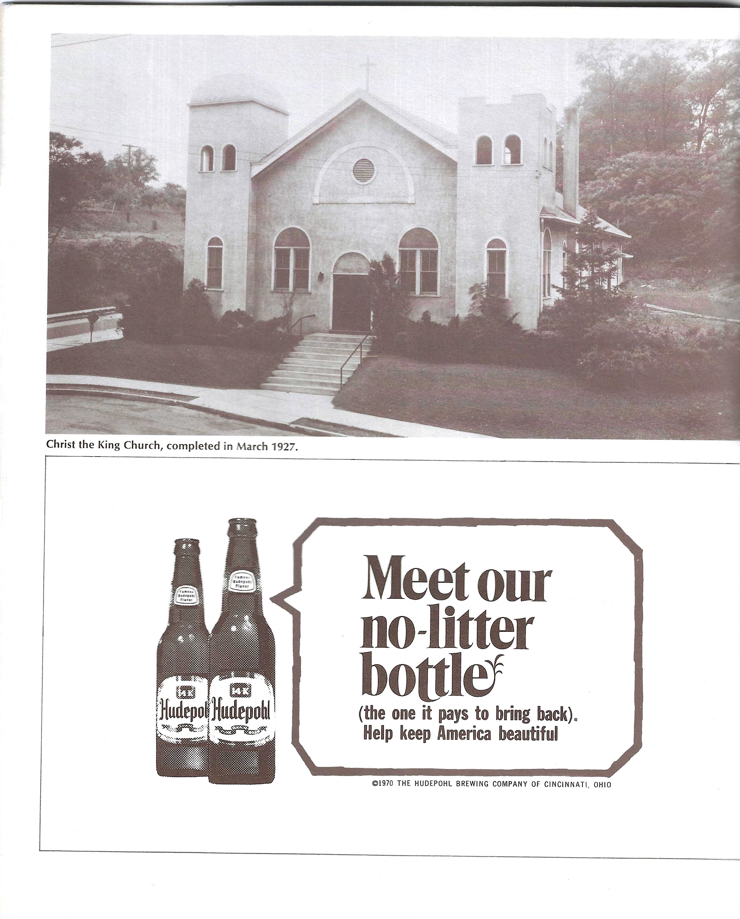
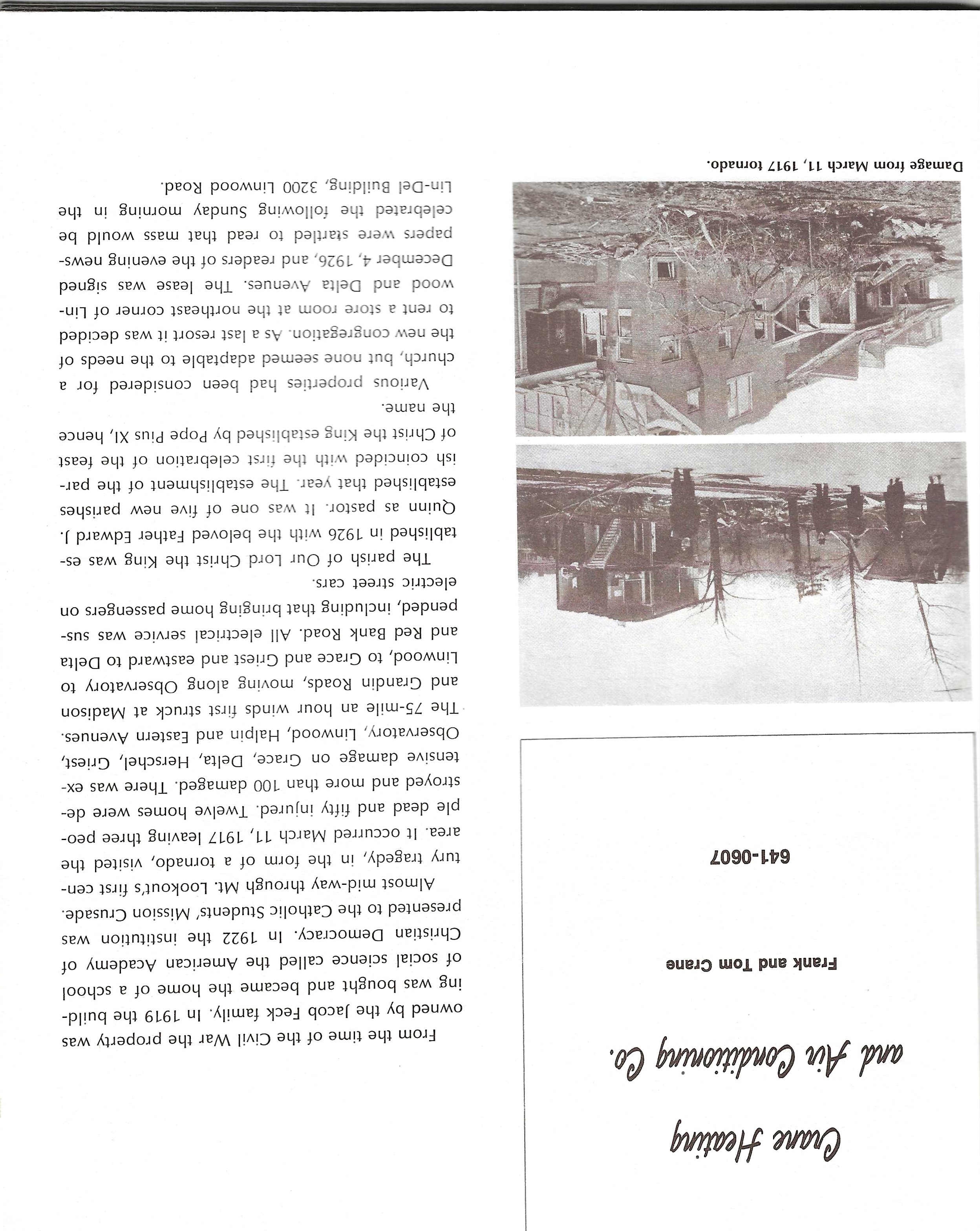
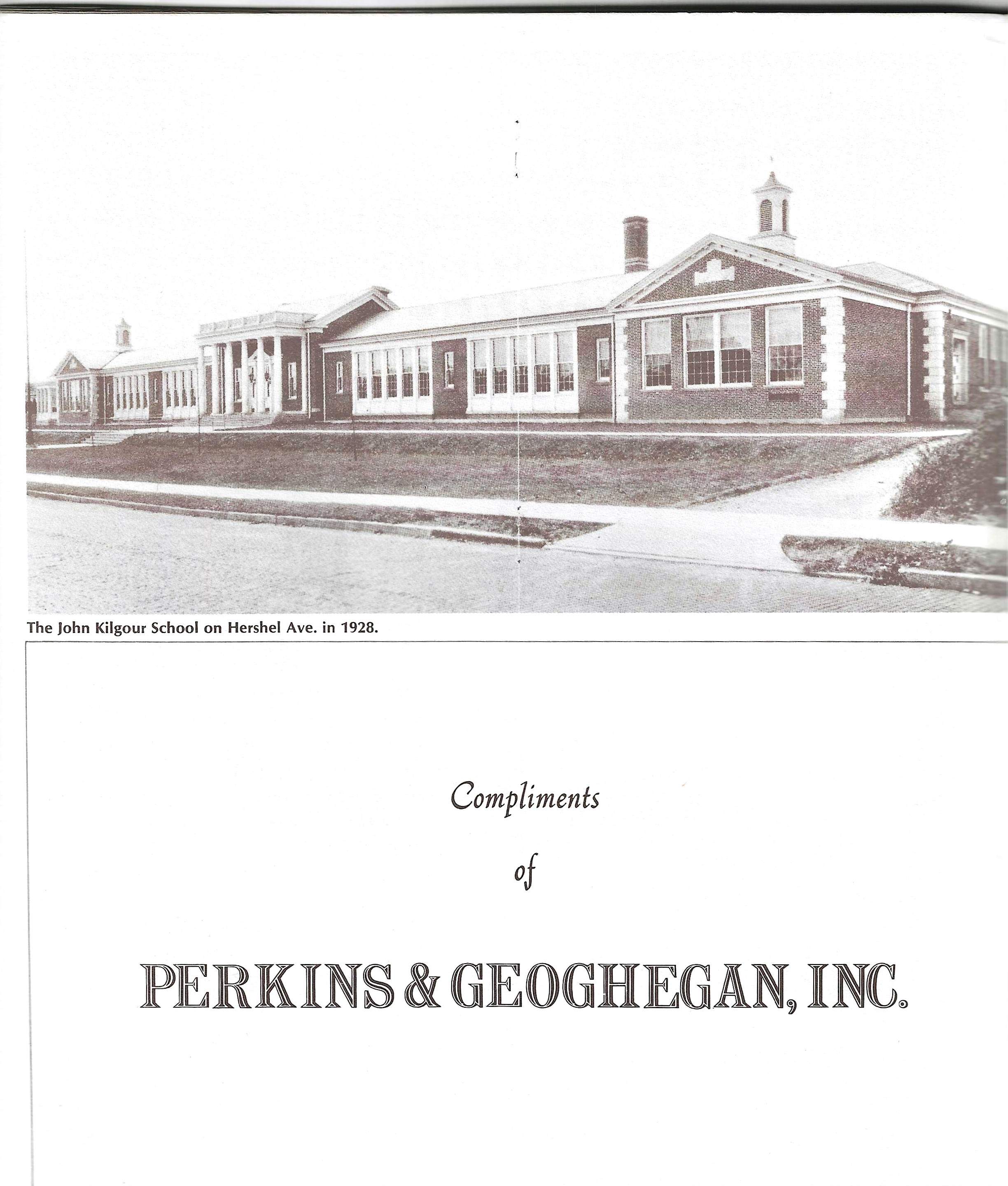
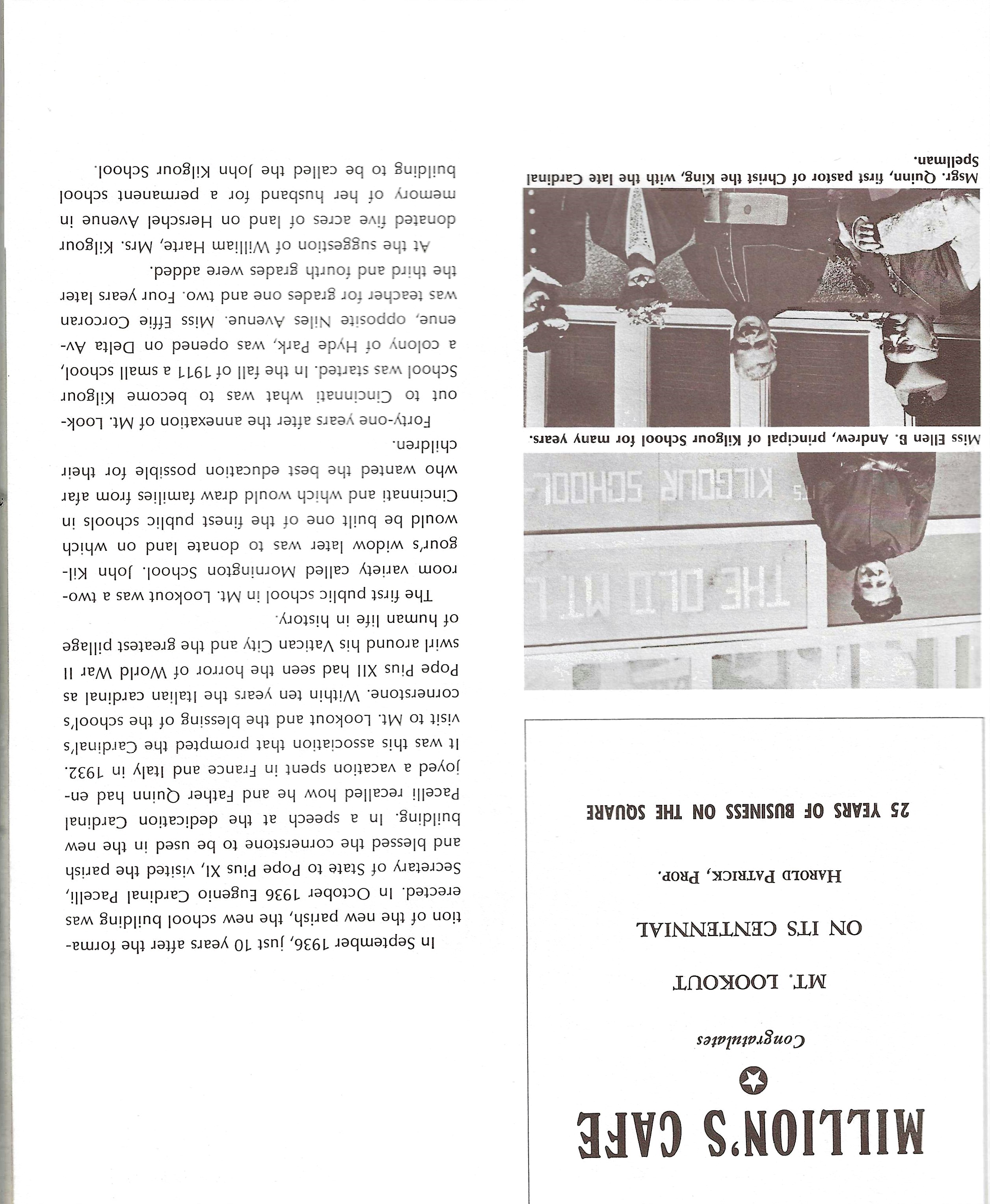
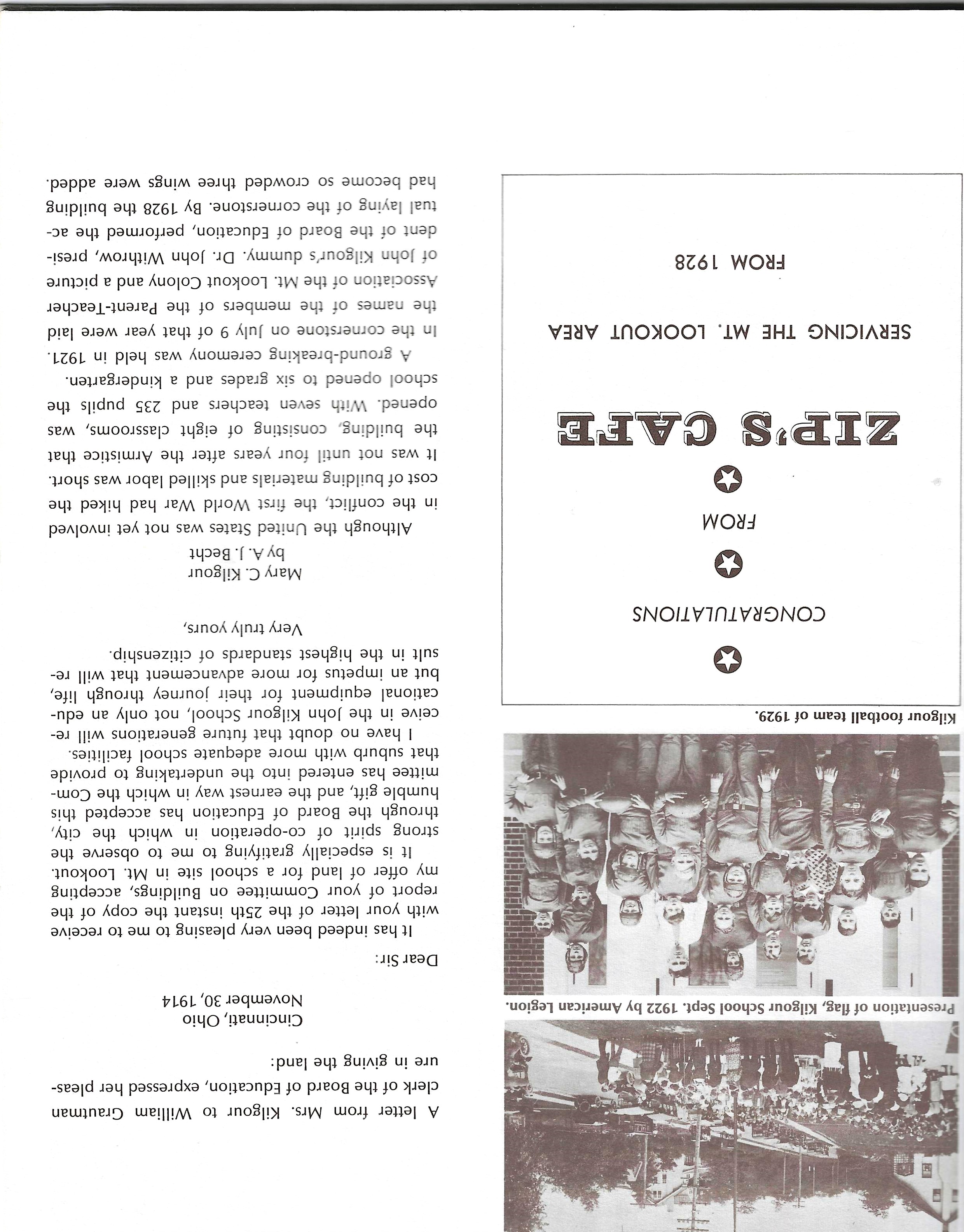
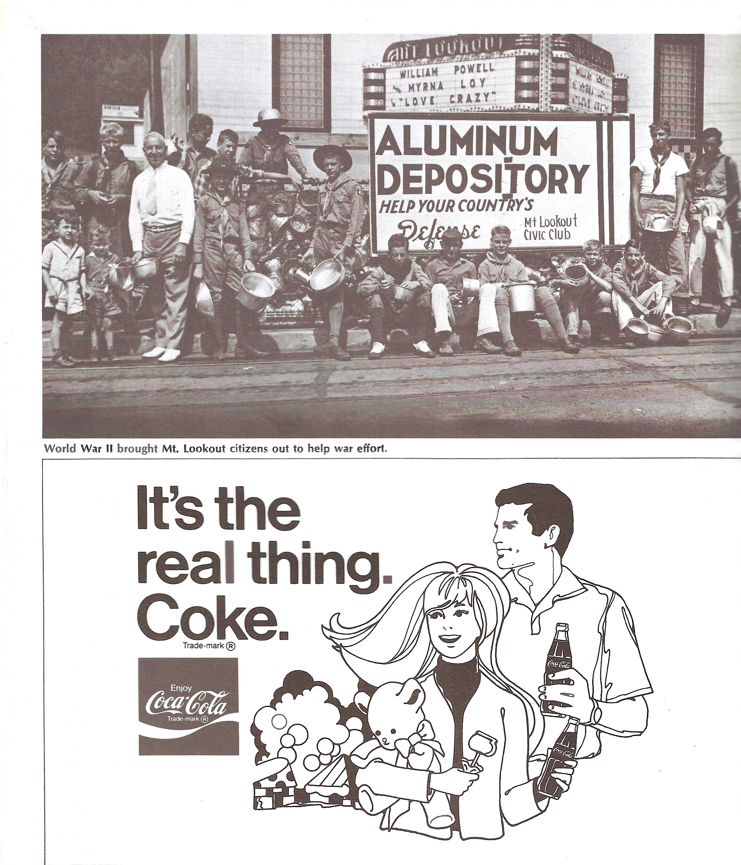
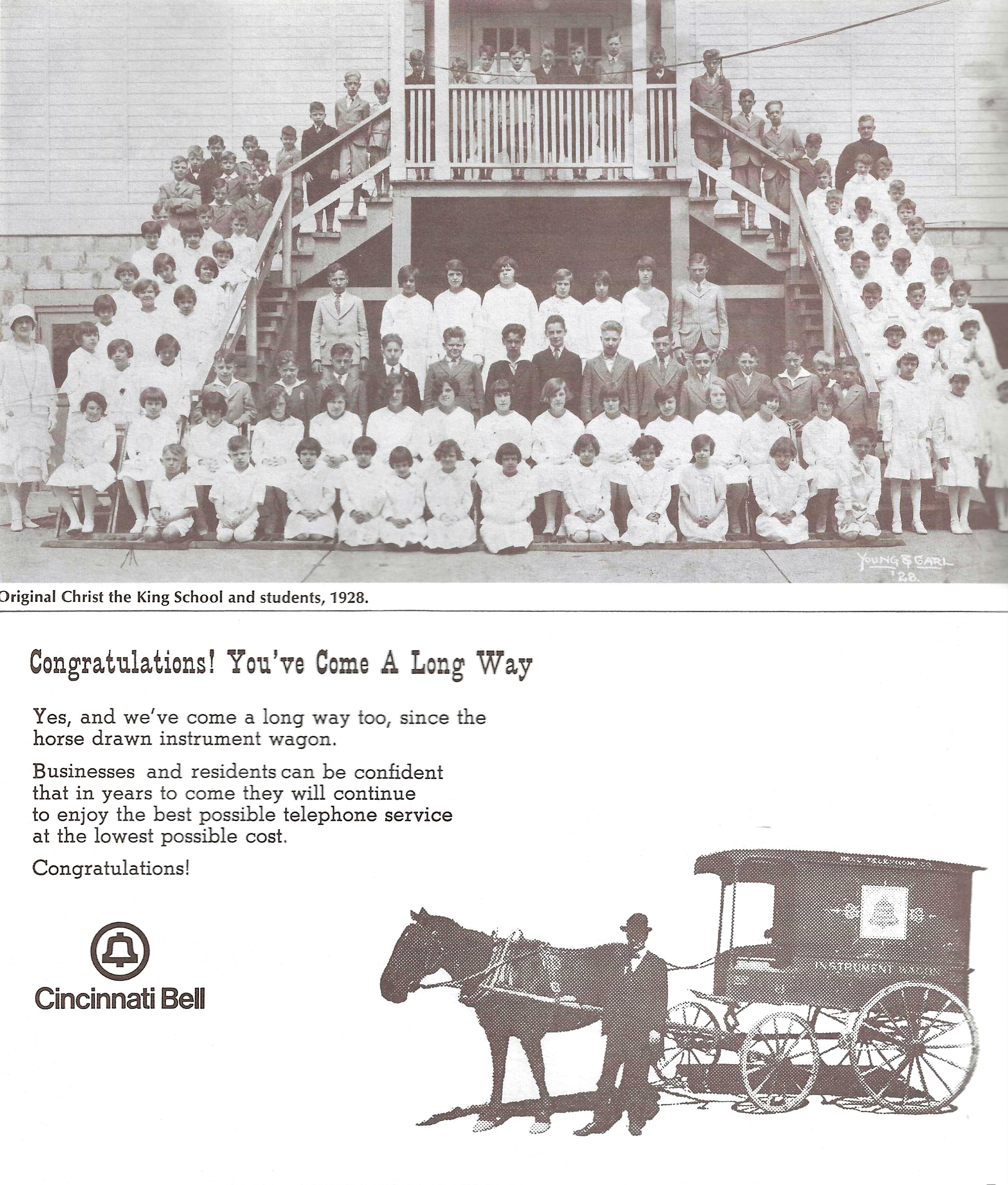
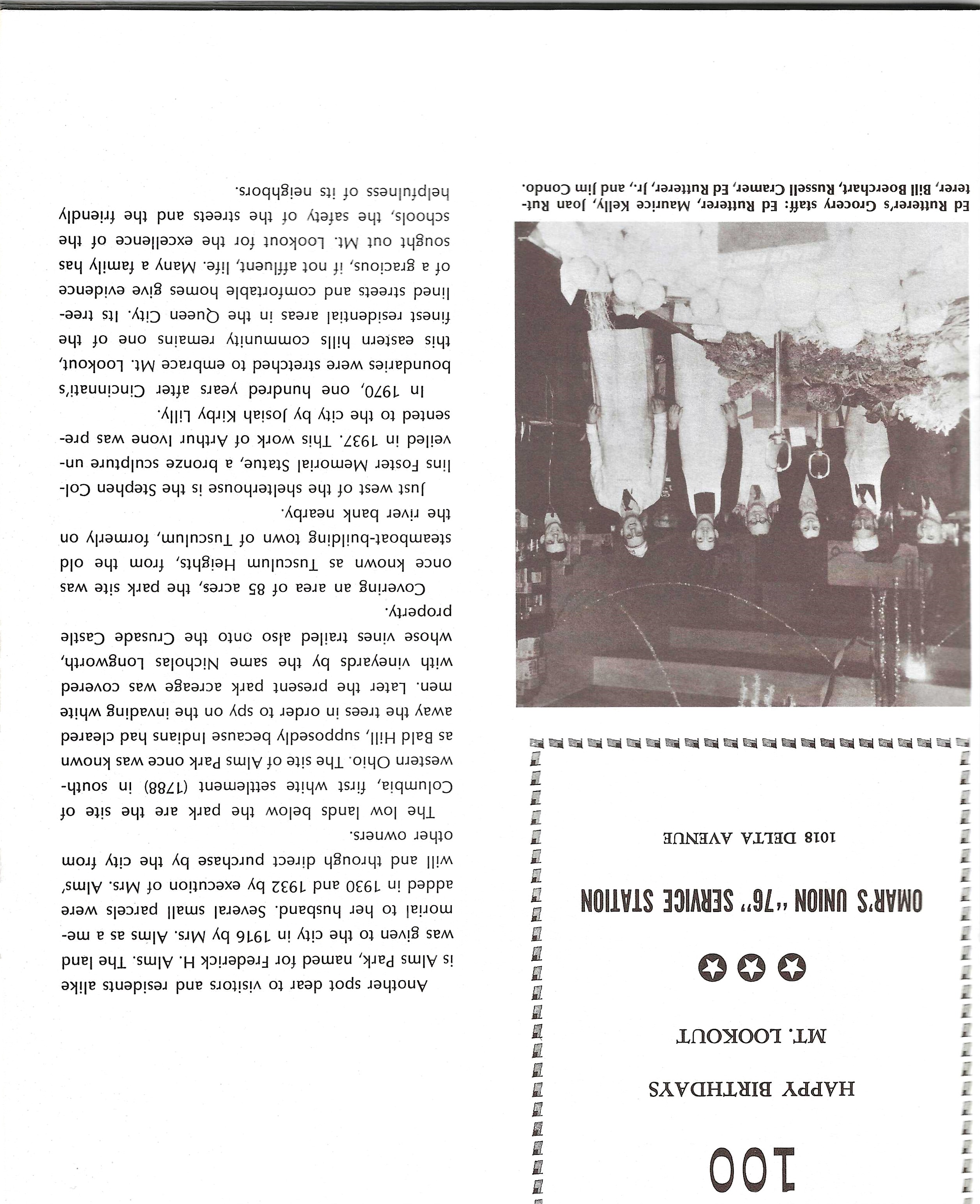
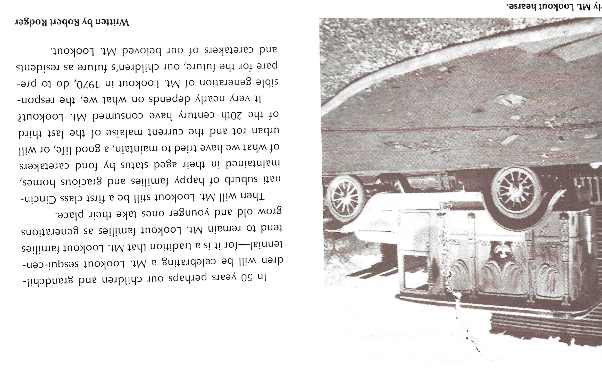
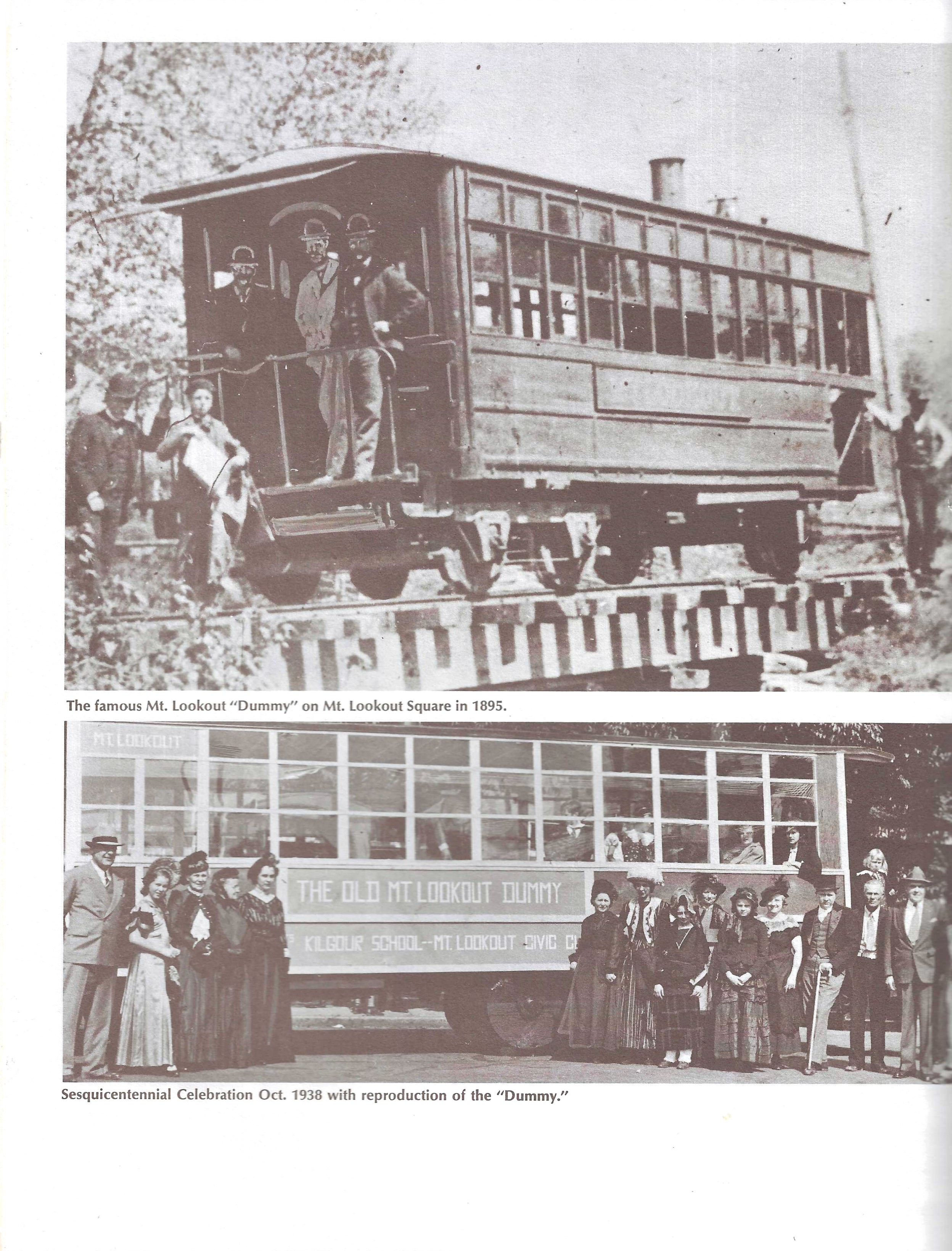
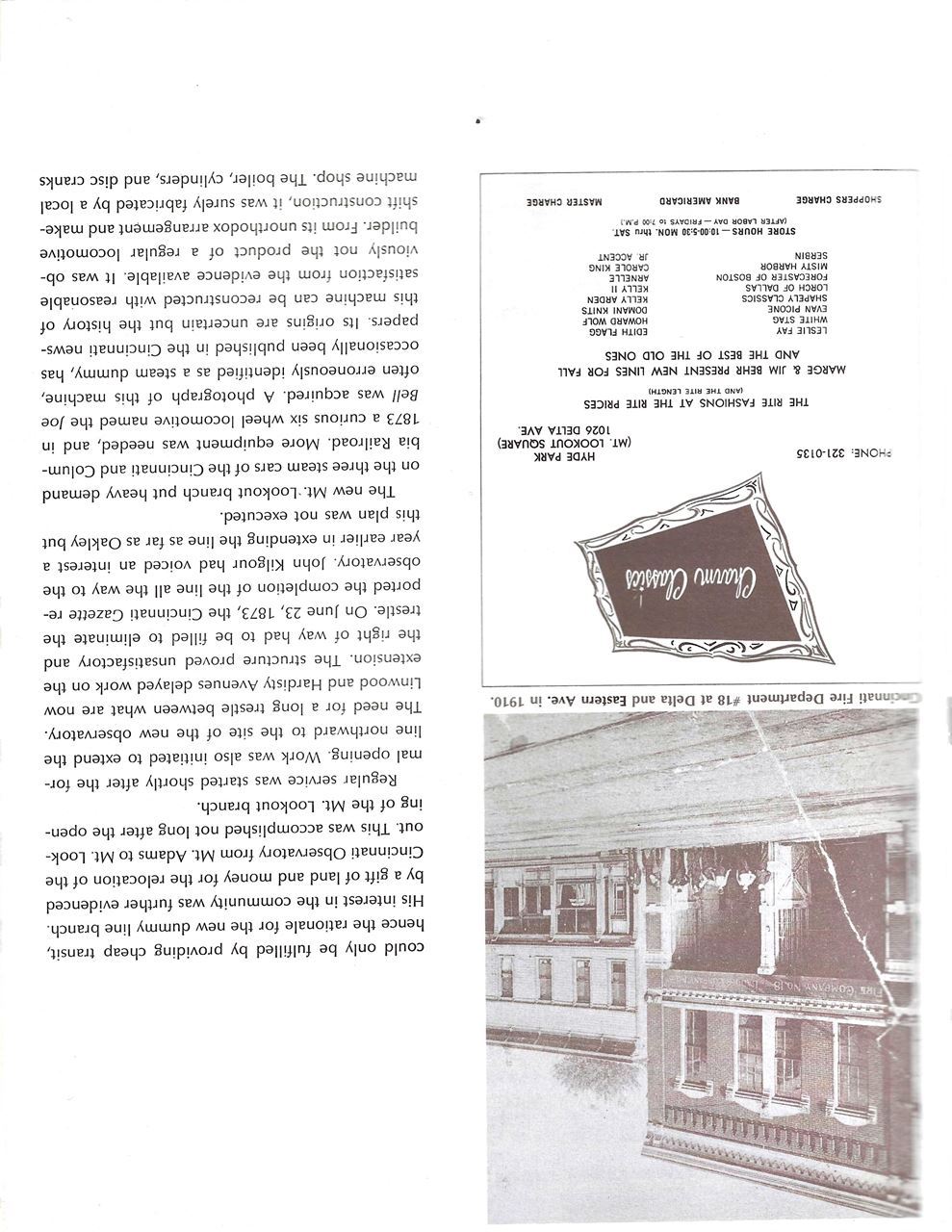
Unknown to most of the present and past inhabitants of what is today Mt. Lookout, their hilly community was once known as Delta, like the north-south artery that rises nearly from the Ohio River to Erie Avenue. Never officially laid off nor incorporated, Mt. Lookout was annexed to Cincinnati in 1870 as a part of Spencer Township. Two years later, the Norfolk and Southern Railroad put a line through the area, and the same year the Cincinnati Astronomical Observatory was moved from Mt. Adams, where it had been some 30 years. The property consists of two brick structures, the main one housing the 16 inch telescope many of the residents of Mt. Lookout have gazed through on star-filled evenings. Mt. Lookout took its name from the wonderful “lookout” at the Observatory. The Observatory property was donated by John Kilgour; also the name of a highly praised Cincinnati public school located nearby. The Kilgour family was a wealthy, enterprising, Cincinnati family which made its fortune in banking and real estate. The family later increased their wealth by investing in street railways and telephone service. In the 1840’s an unusual Italian villa style building was constructed known as “Crusade Castle”. It was the national headquarters for the Catholic Student’s Mission Crusade, and was a center for organized promotion of Catholic missionary work throughout the world. The property was reportedly surveyed by George Washington, and the structure included a massive bed that, according to legend, was slept in by the First President of the United States of America. The land in the surrounding area was very fertile, and was used to harvest large vineyards which inspired renowned poet Henry W. Longfellow to write “Catawba Wine”. Perhaps those vineyards prompted Longfellow to write the famous lines “The Queen of the West in her garlands dressed on the banks of the beautiful river”. By 1870, John and Charles H. Kilgour had begun planning a branch rail line from Crawfish (now Delta Avenue) and Eastern Avenue to Mt. Lookout. Construction of the branch line commenced in 1872. At the time this area was undeveloped countryside. The construction was completed in June of 1872. Unfortunately Charles was injured towards the end of construction, leaving him crippled. Nevertheless, a gala was had to announce opening of the line in 1873. Although this “dummy line” was ultimately a losing business proposition, it continued to operate until 1897. The last remnant of the Mt. Lookout line was the combination Post Office / Station, which was at the west end of Mt. Lookout Square until 1958. It was replaced by a “watering station” for automobiles, called the Gasoline Service Station. In 1917, the area suffered its first major tragedy in the form of a tornado. There was extensive damage to property on Grace, Delta, Herschel, Griest, Observatory, Linwood, Halpin, and Eastern Avenues. The 75 mile per hour winds were responsible for 3 deaths and nearly 50 injuries. More than 100 homes were damaged. A brief history of Mt. Lookout would be incomplete without mentioning two green spaces that have meant so much to families of this community. Ault Park was named in honor of Mr. and Mrs. Levi Addison Ault, who donated about 30 acres of the property. A bronze plaque, with a likeness of Ault, can be found set in a boulder of Ohio rose granite at the south end of the pavilion. Another spot dear to visitors and residents alike is Alms Park, named for Frederick H. Alms. The land was donated to the city in 1916 by Mrs. Alms as a memorial to her husband. The lowlands below the Alms site are known as Columbia-Tusculum, the first settlement in south western Ohio (1788). The site known as Alms Park was once known as Bald Hill, supposedly because Native Americans had cleared the trees in order to spy on the invading white men. In 2024, more than 150 years have gone by since Cincinnati’s boundaries were stretched to embrace Mt. Lookout. Since then, this eastern hills community remains one of the residential areas in the Queen City. Its tree-lined streets and comfortable homes give evidence of a gracious, if not affluent, lifestyle. Many a family has sought out Mt. Lookout for the excellence of the schools, the safety of the streets and the friendly, helpful neighbors. |
Mt. Lookout Community Council PO Box 8444 Cincinnati, OH 45208 Telephone: (513) 400 - 5185 Email: info@mtlookout.org |